#include <world.h>
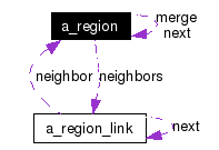
Collaboration diagram for a_region:
Public Attributes | |
| int | ttype |
| int | size |
| short | xmin |
| short | ymin |
| short | xmax |
| short | ymax |
| a_region * | merge |
| a_region_link * | neighbors |
| a_region * | next |
|
|
Merge with region. ??? |
|
|
List of neighbor regions. |
|
|
Link to next region. |
|
|
Size. |
|
|
Terrain type. |
|
|
Maximum x co-ordinate. |
|
|
Minimum x co-ordinate. |
|
|
Maximum y co-ordinate. |
|
|
Minimum y co-ordinate. |
 1.3.6
1.3.6